Ascent – 2693 ft.
Descent – 3895 ft.
Min Elevation – 6133 ft.
Max Elevation – 9262 ft.
High Resolution Topo Maps
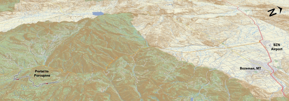
“Attention all riders”… This trail is known to have a high population of bears (not so much on the portal side but rather more on the Porcupine side), so please go prepared with bear spray and bells to make your presence known along the way. Here is a trail that will test your technical uphill skills, make you question your downhill line choices, and somewhere along the way find peace of mind. This trail is best ridden from Portal towards Porcupine. The first portion of trail was at one point traveled by ATV’s so you have some breathing room or line selection on the steep climbs that await as you ascend towards the divide between Portal and Porcupine. As you continue your way towards the top you have a few opportunities for scenic views of Big Sky & Lone Peak in the distance. After most of the ascent is done with you will enter a beautiful and vast meadow. Past the meadow you will reenter the trees and then be privy to your first taste of downhill. The downhill is short lived and you will begin to climb again (short section of hike-a-bike) but then you will arrive at the top of a very steep and rocky climb, here there will be a plaque screwed to a tree about 10ft up (you will see it as you come around the last hard left turn and as you are looking south). Stop and refuel / rehydrate and put on any armor you might normally wear. The plaque signifies you the beginning of the downhill. A word to the wise about this downhill, it is very rocky, with large rocks that are not set into the trail but rather constantly in motion as your front wheel bounces off them don’t expect them to be in the same location for your rear tire. After 2 miles of rocky but fun upper trail, the terrain changes into a super fun roller coaster of sorts as you enter an old forest rich in beauty. Word to the wise, beware of the tight and sometimes hidden corners that come up much quicker than expected. Once you leave the serene forest you will bear right at the junction at 8.2 miles. This last section of trail is super fun with a fast and flowy feel to it.
Driving Directions:
From Bozeman, head west on Huffine towards four corners. Turn Left on Hwy 191 towards Big Sky. Just past mile marker 45 (south of Big Sky) turn left and cross over the river (east side) and drive to the porcupine trailhead. Drop one vehicle here and head back North back past Big Sky to mile marker 53 (north of Big Sky). Turn right on Portal Creek road. Drive up the main road. At about 2.9 miles the road splits, stay right. You will meet another junction about a mile past the first one (Left takes you where you want to start “Upper Portal trailhead & Windy Pass”), right goes to Hidden Lakes trailhead. You can either drive to the Upper Portal trailhead or park at the second junction and ride up to the trailhead. It gives you a nice warmup of pretty mellow logging road.
Google Maps Driving Directions (IOS and Android compatible)
Portal Creek Trailhead
Porcupine Creek Trailhead


