Ascent – 1390 ft.
Descent – 1397 ft.
Min Elevation – 4977 ft.
Max Elevation – 6348 ft.
High Resolution Topo Maps
 Ahh… The M Trail. Known by many as a very steep hike up to the famous “M” on the hillside, high above the valley below overlooking Bozeman. Many tend to neglect the other portion of the trail that splits just a mere 100 feet from the parking lot (left) that is the beginning of the Bridger Foothills trail (or the long/easier route to the M). This trail is great
 to ride early/late season because it is southern facing and receives lots of sun and tends to dry up quickly. Secondly, it has to do with the composition of the dirt. It is mainly a rock base with little to no fine sediment (makings for mud). This helps the trail stay in great shape even with heavy traffic from hikers and cyclists alike. Do not be fooled by this trail, it may not be technically challenging, but it makes up for it in the consistently steep grade. At .8 miles up there will be an intersection for “hikers only” to continue to the M (right). Continue straight ahead on the Bridger Foothills trail. As you make your way north and continue to gain elevation the crowds will diminish quickly giving way to great views of the surrounding valley. Just shy of the 2 mile mark you will pass through a break in a fence and this is where you have the option to turn around or you can continue up a very steep root section another ¼ mile up the trail. If you
  decide to ride up to the top of this next section of dense forest with many exposed roots, you are in for a treat of a very short but fun downhill on the return trip. Please keep in mind during the downhill back to the trailhead that this is a heavy usage trail with hikers, runners, dogs, etc.; keep your speed in check and be kind to other users.
Time Share Trail – More information on timeshare click here.
The trail is open to mountain bikers with timeshare restrictions from July 16th – September 4.
Driving Directions:
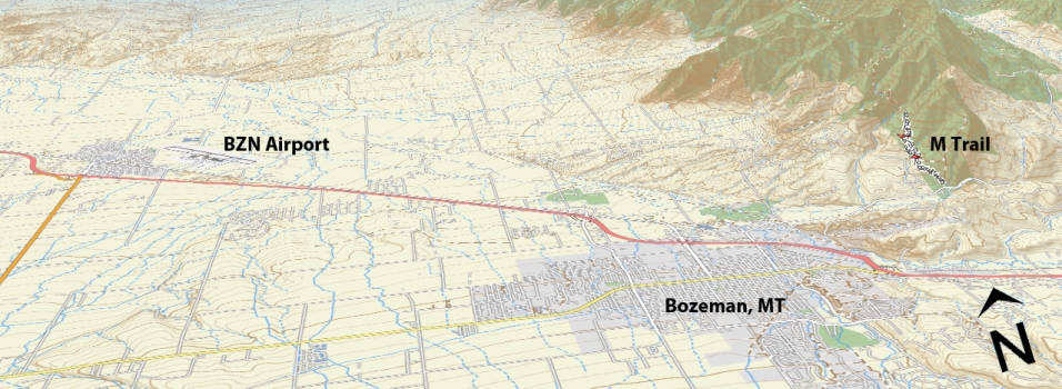
From Main Street in the center of Bozeman take Rouse St. north following signs toward Bridger Bowl Ski Area. After a few miles, turn left into the signed parking area, which is just before a narrow constriction between the Bridgers and the Story Hills.
Google Maps Driving Directions (IOS and Android compatible)
College M Trailhead


