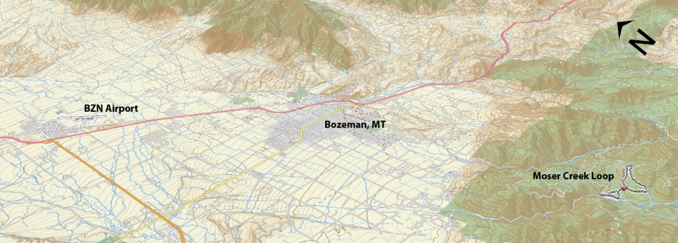
Ascent – 1090 ft.
Descent – 1103 ft.
Min Elevation – 6133 ft.
Max Elevation – 6936 ft.
High Resolution Topo Maps
 The first MTB trail accessible once entering Hyalite Canyon. The trail can be linked to a broad range of trails in the area (Leverich Canyon, Bozeman Creek, and Mystic Lake to name a few). The parking lot is 30 yards up on the right once you turn off the main road. There is a long list of options for trails connected, order ridden, direction ridden, total distance, etc. With that being said, the difficulty ranges from beginner to advanced. From here you you have two options on which way to begin your ride go up the logging road (as if you were to continue driving past the parking lot), or there is a new trailhead on the southeast corner of the parking lot.
Driving Directions:
Departing from Bozeman, drive west on Main Street and take a left (south) on 19th. Continue to drive on 19th Street headed south and west out of town for approximately 7 miles until you reach the turn to Hyalite Canyon. Make a left-hand turn onto Hyalite Canyon Road and continue up approx. 8 miles and make a left-hand turn onto Moser Creek Road. There is a parking lot on your right shortly after turning off of Hyalite Canyon Rd.
Google Maps Driving Directions (IOS and Android compatible)
Moser Creek Trailhead


