Trail Difficulty – Intermediate
Trail Length – 8.0 miles
Trail Time Share – No
Ride Type: Out & Back
Ascent – 2764 ft.
Descent – 2764 ft.
Min Elevation – 4909 ft.
Max Elevation – 7094 ft.
High Resolution Topo Maps
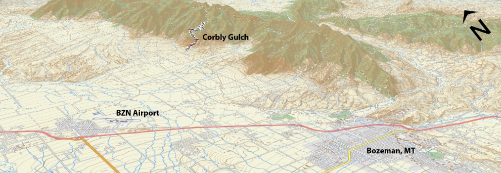
 This trail is starting to gain popularity for its steady but manageable climb and it’s fast, flowy and fun downhill. Located on the western side of the Bridger mountain range, this trail is one drainage north of Truman’s Gulch boasts some incredible views of Ross peak and the valley floor below. The trail has been recently recut (2015) and now gives the rider some room to breathe with a comfortable width single track. The first creek crossing is at the 2 mile marker and a second crossing at 4 miles (from the parking lot at the trailhead). Riders
 can also choose to park where the road meets a cattle guard and becomes steep and rough (if you have a SUV or similar vehicle you will not have any issues driving up to the parking lot, but if you don’t we highly suggest parking at the cattle guard). Parking at the cattle guard adds a mile to each direction and approximately 500 more vertical feet. The second creek crossing is a good place to turn around, but if you choose to continue, the trail becomes very technical (full of derailleur and rotor eating rocks) and goes all the way up to Sacagawea Saddle.
Driving Directions:
From Bozeman, drive north on 7th over the highway and continue onto the frontage road. Continue on the frontage road and take a right at the first light (Springhill Rd) right on Springhill road for approximately 11.9 miles, turn right on Springhill Community Rd. Drive approximately 2 ¼ miles and take a left on Corbly Gulch road. Continue to the end where you turn left at a split in the road (straight is private property and it is marked). Park here at the cattle grate or continue up the 4×4 trail for another mile to the trailhead parking lot.
Google Maps Driving Directions (IOS and Android compatible)
Corbly Gulch Trailheads


