Trail Difficulty – Beginner
Trail Length – 7.71 miles
Trail Time Share – No
Ride Type: Loop / Out & Back
Ascent – 450 ft.
Descent – 440 ft.
Min Elevation – 4844 ft.
Max Elevation – 5060 ft.
High Resolution Topo Maps
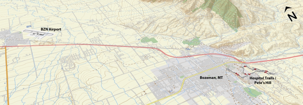
This trail system is nestled away in the heart of Bozeman and gives great opportunities for all skill levels to enjoy a wonderful ride with great scenery just minutes from downtown. Pete’s Hill starts just south of the Library (with a dedicated parking lot) and has a short but steep climb at the beginning. Once you are up the first hill, the trail continues to climb at a more manageable incline with views of Bozeman right from the start. There are many spur paths that head east which will connect with other trails around the Hospital as well as an area called “Painted Hills”. At the top of Pete’s Hill before the trail begins to descend, take a left and the trail will skirt between housing developments as you head east. The trail will begin to change from a wide pea gravel path to a well-established singletrack. Again, the trail will split at numerous points along the trail to either shorten / lengthen / figure 8 your ride. The nice part about the area is that you can see almost the entire area no matter where you are so getting lost is pretty difficult. This trail is a great place to ride early season due at it receives lots of sun and dries out quickly.
Driving Directions:
From Main Street in downtown Bozeman, turn on to South Chruch Ave and drive approx. a ¼ mile (past Bogert Park) and turn left at E. Story street into the Pete’s Hill parking lot.
Google Maps Driving Directions (IOS and Android compatible)
Hospital Trails – Pete’s Hill Trailheads


