Ascent – 2105 ft.
Descent – 2105 ft.
Min Elevation – 5269 ft.
Max Elevation – 6551 ft.
High Resolution Topo Maps
Mystic Lake (Logging Road Up & Down)
Mystic Lake (Singletrack Up & Down)
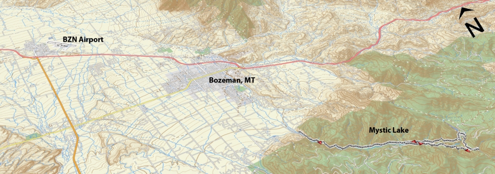
A continuation of Bozeman Creek up along the logging road or you can choose to ride up the single track to the lake. Mystic lake is a great ride for those looking to put a few more miles in on their ride without the large elevation gain that is typical on most rides in the area. Continuing from the bridge up the logging road it is an additional 5 miles (9.8 in total from trailhead) to the lake. When you are riding up the logging road and nearly to the lake, make sure to stay left  once you reach the top of the last steep hill of the logging road. This will take you down through a few corners to the lake edge. From here you have the option to return down the way you came or a second option is to ride down the singletrack back to the bridge. The singletrack begins at the northern corner of the lake (left side when viewed from where the logging road spits you out at the lake. The singletrack is a challenging, off-camber trail that is cut into the steep hillside about 300 feet above the river below. It has been kindly nick-named the ‘wall of death’ due in part to the exposure and a few technical sections that require solid bike handling skills and confidence. If you have any doubt when you arrive at a few of these obstacles just stop and walk your bike a matter of 15 ft and you are good to go and enjoy the downhill. Listed above in the maps is three different options for riding this trail. For more information on Skill/Fitness Levels required for the different routes, please refer to the Trail Ratings page.
Driving Directions:
Departing from Main street in downtown, take South Church Avenue (this will become Sourdough road after crossing Kagy) heading south, turn right on Nash Road (only direction that remains paved) and continue a short distance before turning left on Sourdough Canyon Road (large rectangular sign on side of road). Follow Sourdough Canyon Road until you reach the trailhead at the end of the road.
Google Maps Driving Directions (IOS and Android compatible)
Mystic Lake / Bozeman Creek Trailhead


