Ascent – 2726 ft.
Descent – 2717 ft.
Min Elevation – 4829 ft.
Max Elevation – 7299 ft.
High Resolution Topo Maps
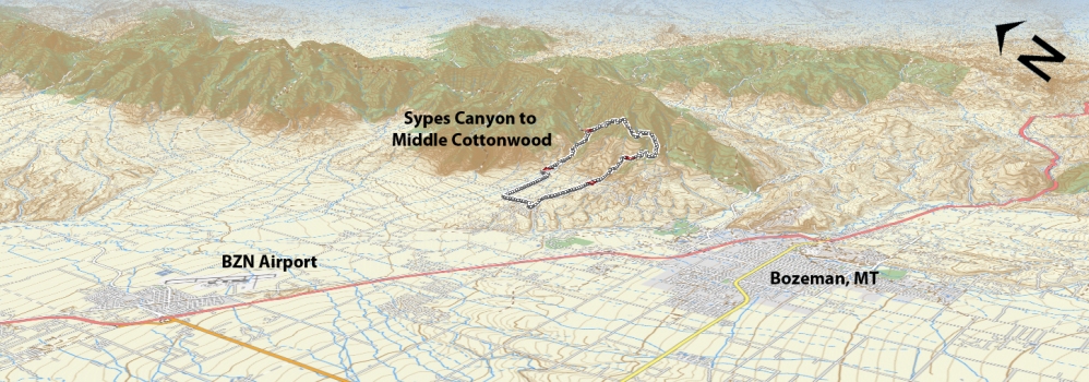
 For the first portion of this trail read Sypes Canyon trail description. Once you reach the 4-way intersection atop of Sypes Canyon trail take a left onto the Bridger Foothills trail heading north towards Middle Cottonwood. The first portion of the trail after departing from the intersection will be a mellow descent for a short distance before you will begin to climb again (3.85 miles) and the trail will progressively become steeper and steeper. Starting around 4.2 miles the trail becomes very steep, off chamber, rocky steps (~10-12” tall) and requires hike-
a-bike for most riders. Once you reach the top at 4.6 miles take a moment to refuel/rehydrate and absorb the great views. Upon beginning the descent be prepared for steep sections which are off chamber with 10-18” drops. The downhill is fun and flowy but please bear in mind that this trail is for experienced riders only. There are many sections that are high exposure and carry with it high risk. Around the 6 mile mark you will enter the lower section of the Bridger Foothills trail as it enters a narrow canyon filled with marsh like tall grass as you follow a stream that flows most of the year. Once you arrive at the intersection at Middle Cottonwood (6.5 miles) you will be required to cross a creek (sorry… there is no bridge and the water can be moving swiftly during early to mid-summer due to runoff). After you cross the creek turn left (going west, downhill) and continue down a super fun (yet fairly technical) lower section of Middle Cottonwood. As you leave the technical rock gardens behind and the trail begins to mellow out be aware of hikers, dogs, other riders, etc. This lower section of trail is used heavily by many, so please keep your speed in check and yield to uphill traffic. Once you reach Middle Cottonwood trailhead continue down the dirt road and it will revert back to asphalt. Ride down to Summer Cutoff Road and turn left. Follow this till you reach Sypes Canyon road and turn left and ride back up to your car.
Time Share Trail – More information on timeshare click here.
The trail is open to mountain bikers with timeshare restrictions from June 16th – September 4.
Driving Directions:
From Bozeman, drive north on 7th over the highway and continue onto the frontage road. Continue on the frontage road and take a right at the first light (Springhill Rd) right on Springhill road. Drive .2 miles then turn right on Sypes Canyon Rd., continuing until the end of the Y at the end of the road; bear right and park at the signed trailhead (6 spots). Overflow parking is available on the right before the final turn to the trailhead (12 spots).
Google Maps Driving Directions (IOS and Android compatible)
Sypes Canyon Trailhead


