Ascent – 2947 ft.
Descent – 2940 ft.
Min Elevation – 5341 ft.
Max Elevation – 6928 ft.
High Resolution Topo Maps
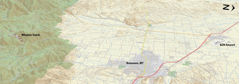
Ahh… another trail to break away from the normal day’s routine and a chance to escape reality. Wheeler Gulch is nestled away just one canyon west of Hyalite Canyon. This trail is for the strong intermediate and higher riders mostly due in part to the consistent steep incline. It is accessed via riding up South Cottonwood trail, just beyond the third bridge there will be an intersection with Wheeler being to the right. Currently there is just large boulders at the creek crossing shortly after the intersection. Keep in mind that during spring runoff and even into early summer these boulders are submerged and the water is moving quick so it is advised to wait till
 early-mid July before attempting to ride this trail. The trail is a true singletrack for the first mile of climbing and then the trail relaxes as you enter the newly recut trail (summer, 2014) that will take you all the way to the summit. The summit is not defined but rather an overgrown area that was leveled by heavy machinery sometime in the past. Here is a great opportunity to take in the incredible views of History Rock (to the east) and South Cottonwood. If you choose to continue beyond this point you will meet up with an old logging / access road (FS980B &FS980A) and come prepared with maps, food, water.
Driving Directions:
Departing from Bozeman, drive west on Main Street and take a left (south) on 19th. Continue to drive on 19th Street headed south and west out of town. Take S. 19th out past Hyalite to the intersection with Cottonwood Rd. Turn left and wind through a big right bend before taking another left Cottonwood Canyon Rd. From there, it’s about 2 miles to the trailhead at the end of the road (please watch your speed “25 MPH” and the residents will love you for it!)
Google Maps Driving Directions (IOS and Android compatible)
Wheeler Gulch / South Cottonwood Trailhead


