Ascent – 2011 ft.
Descent – 1959 ft.
Min Elevation – 6932 ft.
Max Elevation – 8851 ft.
High Resolution Topo Maps
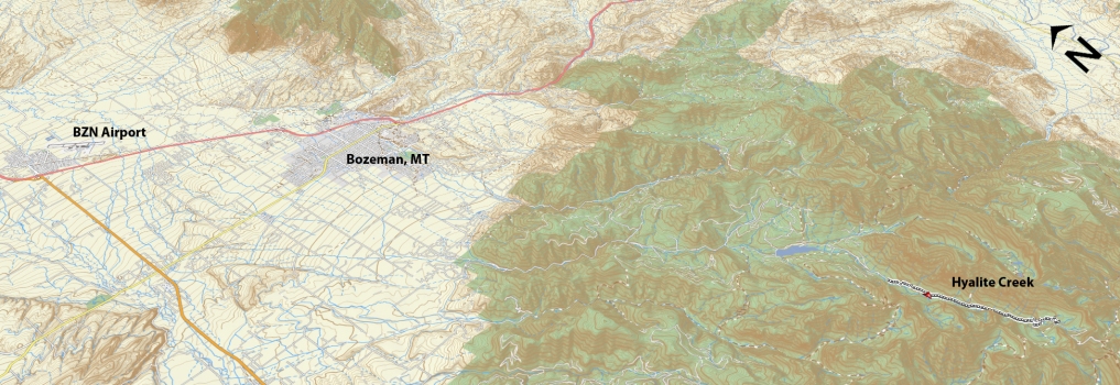
 Another gem of a trail for the rider seeking a very technical, challenging trail! The trail begins as a vehicle width path but quickly narrows once you reach the single track (MTB & Hiking) trail turnoff (.4 miles from the trailhead, go left at the junction). The trail gets right down to business with technichal climbs and mini rock gardens, as it parallels Hyalite Creek path for another ½ mile before joining together again to become one trail. As you ascend
 through beautiful forests and a multitude of creek crossings one thing will remain constant, the trails unyielding grade and difficulty. Just a very consistent and challenging climb. As you ascend, take the time to stop and check out a couple of the waterfalls and spectacular views of the valley below. Hyalite Lake is a remote lake 5.85 miles up from the trailhead that boosts an incredible level of solace and beauty. You can continue to the top of Hyalite Peak, but riders beware, there will be sections of hike-a-bike throughout the next 2 miles on your way to the top. Wherever you decide to turn around, be prepared for some super fun technical downhill. Keep in mind that this is a tight downhill with a high probability of encountering hikers, other riders, stock users, etc. Be alert for uphill travelers and give them the right-a-way.
Time Share Trail – More information on timeshare click here.
The trail is open to mountain bikers with timeshare restrictions from July 16th – September 4.
Driving Directions:
Departing from Bozeman, drive west on Main Street and take a left (south) on 19th. Continue to drive on 19th Street headed south and west out of town for approximately 7 miles until you reach the turn to Hyalite Canyon. Make a left-hand turn onto Hyalite Canyon Road and continue past Hyalite Reservoir; when the road splits, take the right fork toward Hyalite Creek trailhead. Continue for approximately 2 miles to the end of the road and the trailhead parking lot.
Google Maps Driving Directions (IOS and Android compatible)
Hyalite Creek Trailhead


