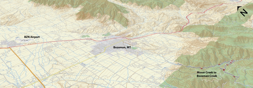
Ascent – 783 ft.
Descent – 1641 ft
Min Elevation – 5287 ft.
Max Elevation – 6695 ft.
High Resolution Topo Maps
Best done as a shuttle for beginners and intermediates. Here is a great choice for riders who would like to enjoy a good amount of downhill on old logging trail (rarely accessed by the forest service). Start at the lower Moser Creek parking lot and ride up the dirt road towards Leverich (left at the split in the road). Continue climbing until you come across a full width gate on your right. Go through the gate and continue straight (down and slightly left) but keep in mind this is an area of secluded forest and lots of wildlife roam through it (especially moose and bears). Ride prepared with bear spray and noise makers of your choosing (bells, etc.). Along the way, you will have some beautiful scenic views of surrounding mountains and canyons as you make your way along and down the mountainside towards Bozeman Creek & Mystic Lake trails. The logging road makes its way to the bridge at Bozeman Creek, about 4 miles from the gate at Moser Creek. Once you reach the bridge just ride over the bridge and follow the logging road for another 5 miles down until you reach the Sourdough trailhead.
Driving Directions:
Departing from Main street in downtown, take South Church Avenue (this will become Sourdough road after crossing Kagy) heading south, turn right on Nash Road (only direction that remains paved) and continue a short distance before turning left on Sourdough Canyon Road (large rectangular sign on side of road). Follow Sourdough Canyon Road until you reach the trailhead at the end of the road. Leave your shuttle vehicle here and head back towards Nash Rd. Turn left and continue till Nash intersects S. 19th. Turn Left and drive until you reach the turn to Hyalite Canyon. Make a left-hand turn onto Hyalite Canyon Road and continue up approx. 8 miles and make a left hand turn onto Moser Creek Road. There is a parking lot on your right shortly after turning off of Hyalite Canyon Rd.
Google Maps Driving Directions (IOS and Android compatible)
Moser Creek Trailhead
Bozeman Creek Trailhead


