Ascent – 9311 ft.
Descent – 8993 ft.
Min Elevation – 4907 ft.
Max Elevation – 8936 ft.
High Resolution Topo Maps
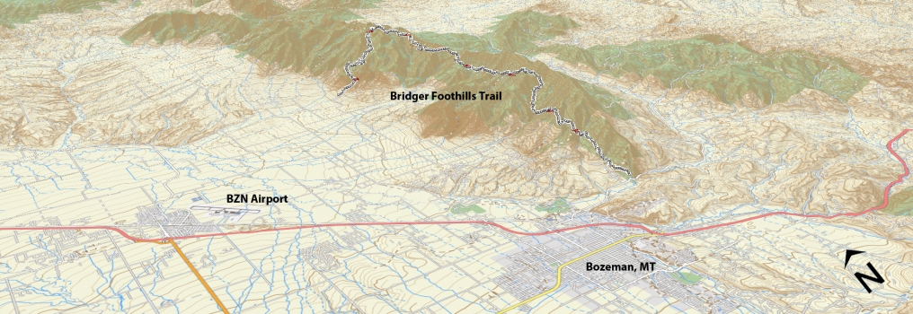
Although listed in here as a ride… it is more of a combination of riding, hike-a-bike, and borders on an expedition, for only the most dedicated riders or individuals looking to see how far they can push themselves. This is not for the inexperienced nor the rider who is not in excellent physical condition. Starting at the base of Corbly Gulch (read Corbly Gulch description) you will continue beyond where most turn around if just riding the Corbly Gulch trail. After  the second creek crossing you will find yourself throwing your bike on your back for a little hike-a-bike and short sections of rideable terrain in your easiest gear. It is approximately 3 more miles (and 1,700 more vertical feet) from the second creek crossing to Sacajawea Saddle (south side). At this point you meet up with the Bridger Ridge trail / Bridger Foothills trail. This is a good time to restock your water supply! For a short distance (⅛-¼ mile) these two trails are one and the same before the Foothills trail splits slightly to the right and downhill. The trail will continue ascending and descending in and out of drainages and gulches the entire length of the Bridger Range. You will be fooled into thinking you are farther along than you really are for the most of the ride. The descents are incredibly steep in places, with loose shale and off camber sections that attempt to pull you off the trail at every opportunity. The climbs are not any kinder. You will be met with mandatory hike-a-bike sections that will last anywhere from ¼ to ¾ mile long. Seriously consider bringing a lightweight pair of hiking / ascent shoes for these
  sections rather than hiking in your riding shoes! The best time to ride this trail is before the creeks and streams dry up from the summer heat but definitely not during the peak of summer temperatures! You will need to bring a water filter to replenish your supply along the way. Speaking in terms of the difficulty of this ride, take the time to plan it out, study maps, and have a few friends or family members as a support crew (have an exit plan if you don’t make it the entire way), Ideally ride with a partner you trust and has strong riding skills and is also physically fit for the ride. Read the, mileage, ascent, descent, and approximate time to complete below. This is not your quick afternoon ride or lunch loop but rather a mental and physical testing, character building, filled with epic views, and above all an unforgettable ride!
Time Share Trail – More information on timeshare click here.
The trail is open to mountain bikers with timeshare restrictions from July 16th – September 4.
Driving Directions:
From Bozeman, drive north on 7th over the highway and continue onto the frontage road. Continue on the frontage road and take a right at the first light (Springhill Rd) right on Springhill road for approximately 11.9 miles, turn right on Springhill Community Rd. Drive approximately 2 ¼ miles and take a left on Corbly Gulch road. Continue to the end where you turn left at a split in the road (straight is private property and it is marked). Park here at the cattle grate or continue up the 4×4 trail for another mile to the trailhead parking lot. You will need a vehicle at the M Trail parking lot or if you are still feeling like you have energy left you can ride back into town.
Google Maps Driving Directions (IOS and Android compatible)
Corbly Gulch Trailhead
College “M” Trailhead


