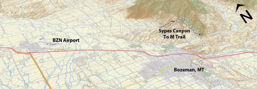
Ascent – 1978 ft.
Descent – 2145 ft.
Min Elevation – 4982 ft.
Max Elevation – 6797 ft.
High Resolution Topo Maps
Fair warning… The downhill section from Sypes Canyon along the Bridger Foothills trail is for riders with solid bike handling skills only! This ride will require a shuttle unless you are feeling ambitious and either ride it from town or ride along the road back to Sypes Canyon parking lot. Read the description of Sypes Canyon for the first half of the ride. Once you
 reach the top of Sypes Canyon trail, it will be marked with a cairn (stacked stones) and just past the trail marking you will come to the intersection of the Bridger foothills trail. Take a hard right (this will connect with the M Trail) and the trail will begin to descend quickly into the drainage. This section of downhill is VERY steep with loose rock the entire way and to top it off much of this descent is very narrow and exposed. This is one of the steepest downhills in the area with high risk. You would not want to fall at any point during this section. Once you make it safely into the drainage below you will have a steep climb up and out. This is the last uphill and the trail will start to wrap around the hillside at a much more comfortable incline as you reach the top and start your descent towards the College M Trail. Beware of the next
  descent when it is wet or early season with damp conditions due to the amount of exposed roots that run diagonally across the trail become incredibly slick! Once you reach the intersection of the Bridger Foothills trail and the College M Trail, go right (downhill) but please watch your speed and pay attention for hikers, runners, dogs, etc. This portion of the trail is heavily used, so be mindful of others.
Time Share Trail – More information on timeshare click here.
The trail is open to mountain bikers with timeshare restrictions from June 16th – September 4.
Driving Directions:
Sypes Canyon trailhead: From Bozeman, drive north on 7th over the highway and continue onto the frontage road. Continue on the frontage road and take a right at the first light (Springhill Rd) right on Springhill road. Drive .2 miles then turn right on Sypes Canyon Rd., continuing until the end of the Y at the end of the road; bear right and park at the signed trailhead (6 spots). Overflow parking is available on the right before the final turn to the trailhead (12 spots).
College M Trailhead: From Main Street in the center of Bozeman take Rouse St. north following signs toward Bridger Bowl Ski Area. After a few miles, turn left into the signed parking area, which is just before a narrow constriction between the Bridgers and the Story Hills.
Google Maps Driving Directions (IOS and Android compatible)
Sypes Canyon Trailhead
College “M” Trailhead


